Farm Planner
Draw your farm map. Hover any plot to see what is happening on it.
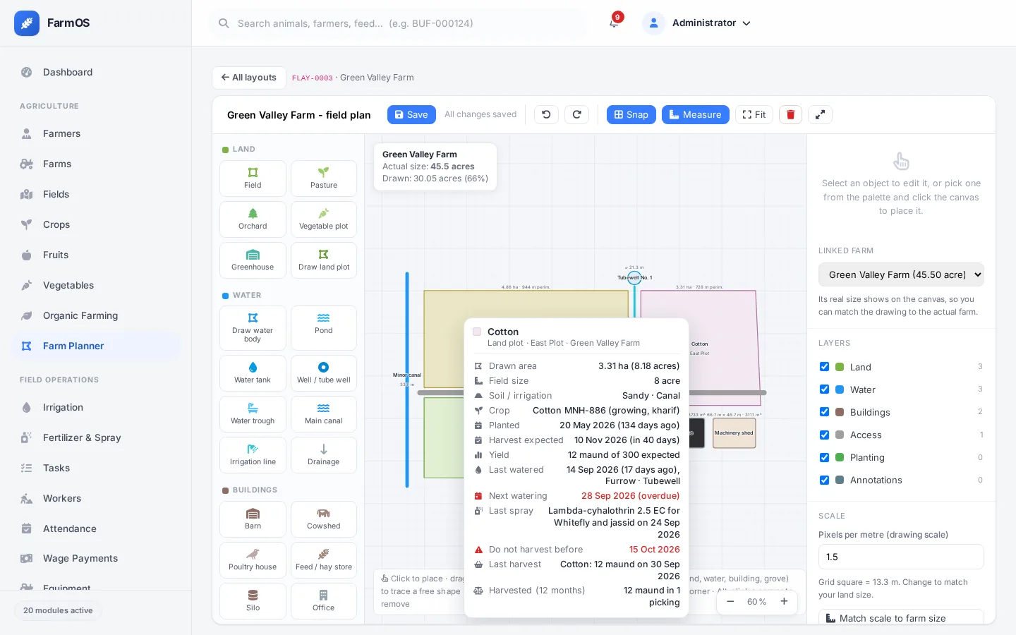
Draw fields, water channels, tubewells, buildings and roads to scale. Link each plot to its field and hover it to see the crop, last watering, last spray, harvest and open tasks.
What it does
- Draw plots corner by corner; neighbouring plots snap together
- Real measurements in metres, acres and hectares
- Match the drawing to the farm's real size in one click
- Hover card per plot: crop, sowing and harvest dates, watering, sprays, harvests, tasks, cold store stock
- Red warnings: watering overdue, do not harvest before
- On phones, tap a plot to see the same and record work for it
The farm map is where everything comes together. Draw the farm once, link each plot to its field, and the map becomes a live view of the season: which fields are thirsty, which were sprayed and cannot be picked yet, what came off each plot and what is still in the cold store.
The details come from whichever modules you use. If you only have Irrigation, the card shows watering. Add Harvests later and harvest lines appear on their own.

See FarmOS with your own farm in mind
Book a 30 minute demo. We show the modules that matter for your farm, using examples from farms like yours.